Natural history of the area
Discover the flora and fauna of Westerbergen holiday park in Drenthe
The Westerbergen site is particularly interesting. On the one hand, it took on its present form a very long time ago; on the other hand, over a period of thousands of years, successive inhabitants have left traces from which we can now draw conclusions about their way of life.
Its earliest history dates back to the penultimate ice age. Geologists – scientists who study, amongst other things, the formation of the Earth and the changes it has undergone over time – have concluded that, in the very distant past, periods of extreme cold were interspersed with periods of higher temperatures. These periods did not last for a few years but spanned epochs of many tens of thousands of years. That penultimate ice age must therefore have begun some 200,000 years ago and lasted no less than 80,000 years. All bodies of water froze, and the ice cap that still surrounds the North Pole grew ever larger. This took the form of ice flows, known as glaciers, such as those we still see today in the Alpine region, amongst other places. These glaciers flowed very slowly southwards, past Norway, Sweden and the Baltic Sea region. As they moved, they scraped against rocks and broke off larger and smaller chunks of those rocks, which were then carried southwards along with the ice. Many of these glacial flows continued on their way, and a large number of them ended up in Drenthe. It is believed that at that time the whole of Drenthe, as far as the Overijsselse Vecht, was covered in ice, with a layer perhaps as much as forty metres thick. As the glaciers advanced, these chunks of rock were constantly being turned over, so that the sharp edges were worn away and much of the rock was even ground down entirely to grit by the ice. In addition, a great deal of sand was carried along. As a result, the stones carried along almost always have a smooth surface and are rounded on all sides.

That ice age was followed by a warmer period, causing all the ice to melt. However, the stones and finely ground gravel remained on the ground. Let us now return to Westerbergen: the many large and small stones found all over the site ended up here during that penultimate ice age. For instance, the low wall surrounding the terrace of the main building is constructed from this type of stone. Those smaller stones, known as ‘finten’ in Drenthe, were formerly used mainly for paving roads; the large stones were used to build the hunebeds, about which more will be said later.
However, the glaciers left further traces at Westerbergen. It is clear that they wreaked considerable havoc on the site and in the surrounding area. As mentioned, along with the stones, the glaciers also carried away the finely ground grit. This has settled throughout the soil as so-called boulder clay. These boulder clay layers are often impermeable to water. They lie in the most extraordinary ways through other soil layers, which is proof that things were anything but calm at Westerbergen during that Ice Age period. This became particularly evident during the construction of the main building, when it was necessary to dig quite deep in order to lay the foundations. It became clear just how strangely the various soil layers are intermingled.
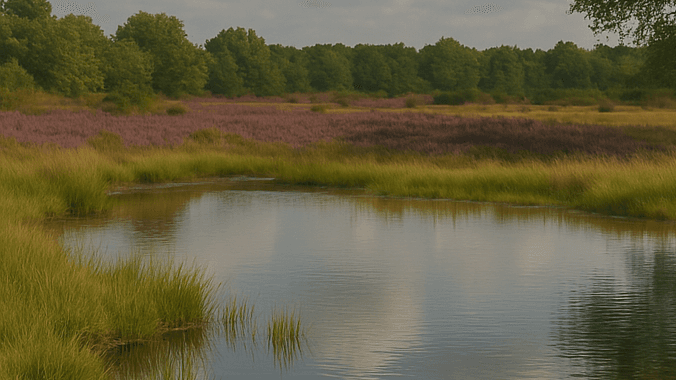
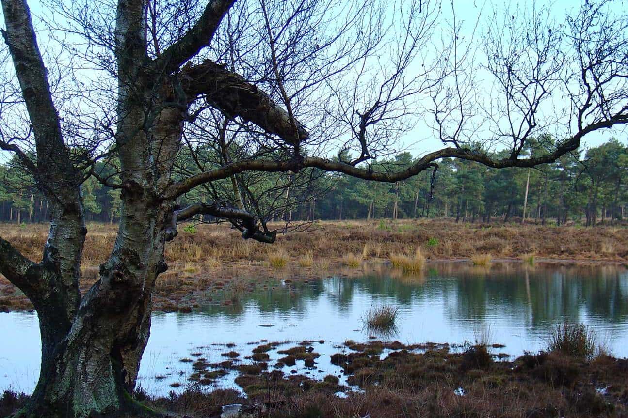
However, there are further indications. Between bungalows 107 to 111 and 115 to 121 lies a pond. Due to the many trees and shrubs surrounding it, it has gradually become barely visible, and moreover, the pond has almost completely become overgrown, but there are still patches of water. Right next to this pond, between bungalows 111 to 115, lies a deep hollow, the bottom of which lies lower than the surface of the water in the pond. Even during the wettest time of the year, there is never any water in this hollow. The pond must therefore lie in a sort of clay hollow, preventing the water from entering the adjacent hollow, whilst there is apparently no clay beneath the latter hollow, given that rainwater flowing in sinks straight away. The glaciers must therefore have been quite active here!
Another remnant from the penultimate Ice Age can be seen a few kilometres from Westerbergen, in the woods on the other side of the Meppel–Hoogeveen railway line. Here lies a so-called terminal moraine, which consists of small mounds of earth pushed up by the glaciers to the point where the glacier came to a halt and melted. As mentioned, this ice age was followed by a period of warmer temperatures. Vegetation began to grow and forests emerged. Animals also arrived. It is not known whether people were already living in Westerbergen at that time. However, it is certainly not impossible. Axes and other flint tools have been found less than 20 km from Westerbergen. According to archaeologists, these objects belonged to people who hunted reindeer, mammoths and other animals. They may have lived some 50,000 years ago. These objects are the oldest tools found in the Netherlands to date. A large number of them are on display at the Provincial Museum in Assen.
Following the warm period, another ice age began. This appears to have started around 70,000 years ago and lasted for 60,000 years. The inhabitants who left behind the flint axes therefore lived during a cold period, but even during the Ice Age there were periods of varying degrees of cold. However, according to archaeologists, it is also possible that these people lived earlier, during the warm period between the two Ice Ages. In any case, they appear to have lived before the end of the last Ice Age.
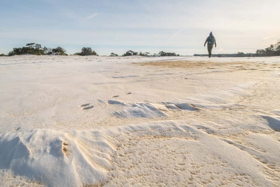
The last ice age did not wreak as much havoc in Drenthe as the one before that. Although the Arctic ice cap did extend southwards again with glaciers, it did not reach Drenthe. As a result of the severe cold, many plants and animals disappeared, large areas of sand were exposed, and storms shifted the sand, forming a layer over soil strata that had formed during the penultimate Ice Age and afterwards. It was during this period that the landscape of Westerbergen largely took on its present form. This Ice Age also left behind several traces. As a result of the extreme cold, the ground was frozen to a depth of tens of metres. As it gradually became warmer again, the top layer thawed during the summer months but froze again during the winter months. Between these two layers, there was sometimes a layer of water, which came under such high pressure that an ice dome, as it were, formed, which burst open like a mud volcano when the pressure became too high. A basin formed in the ground, surrounded by a small earthen embankment. The basin subsequently filled with water. In this way, many small ponds were created, and a clear example of this is the paddling pool at the campsite. Around the pond, remnants of the earthen wall are still visible in various places. This type of eruption apparently still occurs today in the cold regions of Greenland, where the Eskimos who live there call these small lakes ‘pingos’. This name has been adopted for the small ponds in Drenthe, which were formed in the same way; here they are called ‘pingo ponds’.
The
basin has not always been filled with water. If there is no water in it, they are called glacial basins. A very fine example lies on the heathland north of Westerbergen, on the northern side of the blue walking route.
During the last ice age, other factors also caused depressions to form in the ground, which later filled with water and became small ponds. In addition to the pingo pond, four other ponds were formed on Westerbergen during this period. The pond situated between the bungalows has already been mentioned. There is another large pond in the middle of the wooded area and a smaller one just to the south of it. The red and yellow walking routes pass between these two ponds. The fourth pond lies on the eastern side of the site, with half of it on Westerbergen and the other half on the adjacent land. The yellow walking route runs around half of the pond.
As the climate gradually warmed at the end of the last ice age, vegetation began to grow again, particularly woodland. For various reasons, the groundwater level rose. The aforementioned hollows filled with water, in which the trees and many plants were, as it were, drowned. They were only partially decomposed, and over the centuries new generations of plants accumulated, resulting in the formation of a bog.
The bog played an important role in Drenthe right up until the 20th century. Excavated, dried and cut into blocks, these formed the peat. It was an important source of livelihood when peat was used everywhere as fuel. This has now practically come to an end, primarily because there is almost no unexcavated peat left, but mainly because peat has been replaced by better fuels such as coal and, in recent decades, oil and natural gas. There was a brief resurgence during the war years of 1940–1945, when no other fuel was available. The ponds of Westerbergen,
too, have become filled with peat over the course of many centuries, and this peat has been excavated here and there. This is very clearly visible in the large and small ponds in the woods.
Everywhere one sees more or less rectangular patches of water, where the peat has evidently been excavated. Even in the pond situated between the bungalows, the traces of the excavated peat are still clearly visible. The right to excavate a small pond was often granted by the owner to an interested party. This practice continued into the 20th century. For instance, at the beginning of this century there was an innkeeper in Echten named Roelof Muller who held the right to excavate the pond between the bungalows. Many ponds were named after their right-holders. Thus, the small pond between the bungalows was known as Roelof Muller’s pond. There was also originally a small pond at the tip of the meadow not belonging to Westerbergen, where the blue walking route makes a sharp bend to the right. It has now almost completely overgrown, but the spot can be recognised by the bent grass growing there. When the groundwater level is high, parts of it are flooded. In the old days, this small fen was named Dijkman’s pond after its owner. The excavation could be carried out in a rather haphazard manner, as was done particularly in the large fen, but it could also be done more systematically. A splendid example of a neatly excavated fen can be found on the heathland north of Westerbergen, just south of the aforementioned glacial basin. The blue walking route runs between the glacial basin and the fen. Here, neat ditches have been dug and the unusable earth has been deposited on either side, creating a whole row of small embankments.
To continue briefly on the subject of the bogs, it should be noted that as excavation work has now ceased, the bogs are becoming increasingly overgrown. The pingo bog, for instance, had already become completely overgrown. In 1968, it was excavated and all vegetation, peat and black soil were removed down to the sand, creating a paddling pool. Unfortunately, the layer of sand that was deposited during the last ice age over the loam brought in during the penultimate ice age is not very thick, so that the grey loam mixes with the water here and there. The rate at which a fen becomes overgrown can change quite rapidly due to fluctuations in the water level. In the post-war period, the water boards did a great deal to improve drainage. Farmland that used to be flooded in winter now remains dry. As a result of all this, the groundwater level has dropped, and consequently so has the water level in the ponds. The effect of this has become very clearly visible in the large pond. About ten years ago, in 1962, one could see right across the pond. Only in a few places had a small birch tree managed to grow. Birch trees can tolerate quite a lot of water, but if it is too wet, they simply cannot survive. Thanks to the lowering of the water level, the growing conditions for the birches have improved considerably. In the space of ten years, the situation has changed radically, so that nowadays, particularly in summer, the fen is barely visible and one rather gets the impression of standing in the continuation of the forest.
Having described the formation of the fens, we have followed their development up to the present day; however, it is now necessary to return to the period immediately following the last Ice Age, that is to say, to focus our attention on the time some 10,000 years ago. It has already been mentioned that extensive vegetation, and particularly forest, developed fairly quickly. It can be assumed that the drier parts of Drenthe formed a vast primeval forest. With the vegetation, the animals also returned, and indeed the people. It is known that these first groups, tribes or whatever one wishes to call them, lived mainly by hunting. Metals such as bronze and iron were not yet known, and tools were made from flint, just as with the inhabitants mentioned earlier. Pieces or splinters can be chipped off this type of stone quite easily, creating sharp edges, which meant the stone could serve as an axe, knife or other utensil. When crafting these objects, the flaked flint fragments were discarded as worthless material. A number of such flint fragments were unearthed during the construction of the Westerbergen campsite in 1962, providing evidence that people inhabited Westerbergen in the period shortly after the last Ice Age.
The flint fragments in question are now on display in the showcase located in the main building between the hall and the canteen.

The Pesse boat dates from around the same period, perhaps with ‘only’ a few thousand years’ difference. At this site, located about 7 km from Westerbergen, a hollowed-out tree trunk in the shape of a boat was found. The boat, estimated to be 6,500 years old, is the oldest ever found in Europe. It is on display at the Provincial Museum in Assen.
No other province has yielded as many archaeological finds as Drenthe. A wide variety of different peoples, each with their own cultural patterns, have lived in Drenthe over the course of thousands of years. It would serve no purpose to list them all within the scope of this text. It will suffice to mention only those groups for which there are indications that they resided in Westerbergen. An exception will, however, be made for the hunebed builders, as it is not known whether they were present in Westerbergen. There are two reasons why it is desirable to mention this group: firstly, because they were the most well-known population group of prehistoric times precisely due to the hunebeds, and secondly, because a hunebed has been erected on the lawn in front of the main building for decorative and educational purposes.
It is known that the hunebed builders lived mainly from agriculture. They were therefore much more tied to a specific place of residence than the tribes previously living in Drenthe, who lived by hunting. As they were found in a specific location, it stands to reason that they were willing and able to do more for their dead than nomadic hunters. They evidently held their dead in high esteem. For them, the dolmens were built as a kind of burial chamber. The basic structure always consists of two rows of stones covered by capstones. Furthermore, there is a stone at each of the two short ends, and usually a sort of entrance has been created in the middle. The whole structure was covered with earth, which, however, has been washed away and blown away over time. The hunebed builders lived around 2000 BC. One must have great respect for these people, who were able to move the heavy stones (some weigh 20,000 kg) using very primitive tools and construct them into hunebeds.
There are no hunebeds in Westerbergen and the surrounding area. They are found in western Drenthe in the hilly region of Havelte and Diever, and further afield, mainly in eastern Drenthe on the Hondsrug. For instance, there is one just a few minutes’ walk from the Hunzebergen holiday resort in Exloo. The possibility of building dolmens in Westerbergen and the surrounding area certainly existed, as the large stones that, as already mentioned, arrived in Drenthe during the penultimate Ice Age, are also found here. To decorate the lawn in front of the main building, a small hunebed was first constructed using a few stones found in the vicinity of Westerbergen. This proved easier than the method the hunebed builders would have used. The stones were, in fact, put in place with the aid of a small crane truck. During the excavation of the pingo fen to create a paddling pool, a number of large stones were uncovered. With these, the small hunebed was then expanded into a proper hunebed.
Following this detour to the hunebeds, we now turn to another find that came to light during the construction of the campsite. This find consists of a large quantity of urn shards. These urns appear to have been used by the people who lived around 500 BC. The urns were used to hold the cremated remains of the deceased and were subsequently buried in the ground. These shards are also kept in the display case mentioned earlier.
A completely different group of people, who lived from around 100 BC to 100 AD, cremated their dead and then built a small mound, a burial mound, over the remains. Three of these can be found in the northern part of Westerbergen. They can be reached by following the yellow or red walking route. On the adjacent heathland, there are about twenty of these burial mounds. Burial mounds were erected at different times by different peoples. Sometimes the deceased was buried in the mound, with or without grave goods, but in other cases, such as at Westerbergen, no grave goods were included and, as mentioned, the mound was erected over the cremated remains.
Archaeologists therefore have no reason to excavate these mounds, as it is known that nothing will be found there anyway, except perhaps a few remains of charred bones. When one looks at the mounds, they appear to be ordinary sand mounds, such as those found everywhere on uncultivated land. The question then immediately arises as to how one knows that they are burial mounds. The proof is simple to provide. The soil at Westerbergen consists almost entirely of sand, but the top 10 to 20 cm is black earth, which has been formed by hundreds of years of plant growth. If one begins digging at the top of a burial mound, the black earth appears first, and beneath that the sand. If one digs further, one sees sand and more sand until one reaches the horizontal plane, i.e. level with the surrounding terrain. A layer of black soil then appears again, and beneath that, sand once more. This second layer of black soil is proof that the mound was created by human hands. Had the mound formed naturally, this second layer would be missing.
Westerbergen owes
its name to the burial mounds. Until around 1936, the area was a heathland from which only the burial mounds rose. Seen from Echten, they were small hills to the west of Echten, which is why the region was referred to as Westerbergen by the people of Echten in the distant past.
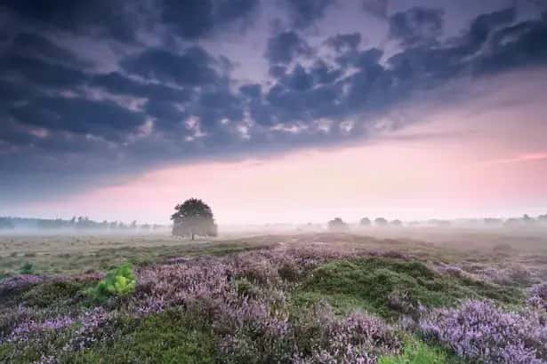
It seems unlikely that the area has always been heathland. As mentioned earlier, forests began to appear everywhere soon after the last ice age. When, in the distant past, a population settled there that lived off agriculture, a simple way to obtain farmland was to burn down a section of forest. The cleared land could be used for farming for a time. It was fertilised with manure from domestic animals, but the possibilities were limited. Mainly because artificial fertiliser did not yet exist and the soil became depleted. People would then clear another patch of woodland and leave the original site to its own devices. Heathland then developed. The heather plant needs plenty of sun, so no heather grows under trees. If nothing else was done, trees would eventually reappear in that heathland and the cycle could begin again. However, the heathland was also used for grazing sheep. As soon as sheep are introduced to the heathland, no woodland can develop. As soon as any new saplings appear, they are eaten by the sheep. It follows that the heathland, which is often regarded as the natural vegetation of Drenthe, is in fact not. The natural vegetation is woodland, and the heathland is actually a cultural product. Until about fifty years ago, sheep farming was always an important source of livelihood in Echten. There are still several beautiful old sheep pens in Echten, though they are no longer used for that purpose. Sheep farming has come to an end. It is no longer a viable livelihood, and moreover, most of the heathland has disappeared due to its conversion into agricultural land. Now that sheep are no longer kept, this means that the heathland is gradually becoming overgrown.
This is very clearly visible in the heathland bordering Westerbergen on the north side. One advantage of keeping sheep on the heathland is that it keeps the vegetation short and makes it look beautiful, especially when the heather is in bloom.
For as long as anyone can remember, Westerbergen has therefore been a heathland. The map from the Municipal Atlas of the Netherlands dating from 1867 also gives the impression that the entire area was then one large heathland; yet there are indications that at least the present-day campsite – that is, the section situated on the south side of the public road – was used for agriculture in the distant past. This road is called Oshaarseweg, named after the hamlet of Oshaar, which lies slightly further west. These indications are the hedgerows: small embankments overgrown with trees and shrubs. In earlier times, when a piece of land was cultivated, such a hedge was erected around the plot. The intention was that the hedge should prevent drifting sand, whipped up by strong winds, from settling on the cultivated area. Another function was simply to mark the boundary of the land and, if the land was used as pasture, to prevent livestock from straying off the land. Historians believe that the hedgerows sometimes served other purposes as well, for example when they were constructed on either side of a road, and that under certain circumstances the hedgerows played a role in specific pagan religious customs.
It is generally impossible
to say how old the hedgerows are. Some date back to historical times, but small hedgerows have also been created in the recent past. Particularly if there is a ditch next to the embankment, the embankment usually did not originate very long ago, as the excavated earth was deposited on one side of the ditch. There is little information available regarding the origins of the hedgerows on Westerbergen. Even the well-known map from 1635, produced by Pijnacker, provides no definitive answer. A copy of this map hangs in the canteen. However, this map does show that the Oshaarseweg already existed at that time. Incidentally, one should not expect much from the roads of that era. They were little more than cart tracks through the heath. If a particular section became too worn, people would move a few metres to the left or right, so that the road was constantly being re-routed. It was not until 1922 that the Oshaarseweg was paved, and in 1966 it was asphalted. Between the Oshaarseweg and the campsite, specifically along the easternmost section, there is still a very distinct hedgerow. This is likely of ancient origin. For as long as anyone can remember, the area behind it has always been heathland. Yet it is not impossible that this area was once cultivated land. There is, in fact, further evidence to support this. The urn shards mentioned earlier were found quite close behind this wooded bank. They were all small fragments; no larger pieces or a complete urn were found anywhere. This suggests that the soil in which these urns were buried was once disturbed, and the most likely explanation is that a plough went through it.
The situation
is different in the rear section of the campsite, namely the area where the seasonal caravan site is located, as well as the area behind the paddling pool and the clubhouse. This section was first acquired by Westerbergen in 1966 to expand the campsite and was then entirely used as agricultural land. Reportedly, the central part of this area remained heathland until shortly after the Second World War and was only then first cultivated. The seasonal caravan site and the easternmost section had already been cultivated some time previously. It seems likely that the cultivation of the seasonal site took place a very long time ago. Surrounding this section is a hedgerow, whilst just behind it, on land that no longer belongs to Westerbergen, there are still many hedgerows which, in a curious manner, completely or partially enclose small, irregularly shaped patches of land. The significance of these hedgerows there is unclear, although there are theories on the matter; however, from this irregularity it can at least be concluded that there was some activity here in the distant past.
In connection with the hedgerows, it is worth noting that a so-called ‘markeweg’ runs along the south-western boundary of the campsite, flanked by hedgerows on both sides. The first section of the road, starting at the Oshaarseweg, is no longer in use and has almost become overgrown. The second section runs alongside the seasonal campsite and is still in use as a footpath. This section forms part of the yellow walking route. Regarding this road, it is worth noting that in the past, almost everywhere in Drenthe, the land situated some distance from the villages was jointly owned by the farmers, the so-called ‘markgenoten’. This was also the case in Echten. In 1879, the land was divided up, but the roads remained communal property. They remained the property of the mark and are still known today as mark roads. This division of the land had a peculiar consequence. For instance, the owner of a farm situated slightly west of Westerbergen could no longer reach his farm from Echten via the communal mark lands. It was, of course, possible to do so via the Oshaarseweg, which was owned by the municipality. The owner in question did not wish to be dependent on the municipality and, in 1880, created his own path across his own land from Echten to the farm in question. This path ran along the northern boundary of Westerbergen. The section of the red and yellow walking route from the third burial mound to the picnic area at the northernmost tip of Westerbergen is therefore still this old path, and traces of the road running from bungalow 105 to the third burial mound can still be found. It is said that something once happened on this path between the postman and some pretty young girls from Echten. Since then, the path has been called the ‘Juffertjespad’.
This text is taken from the booklet ‘Het ontstaan der Westerbergen’, compiled by Dr E.J. Offerhaus
Sign up for the newsletter
Protected by reCaptcha, Privacy Policy and Terms of Service apply.